HP's Ocean Function Page
Ocean function without any edits, resolution is 5 minutes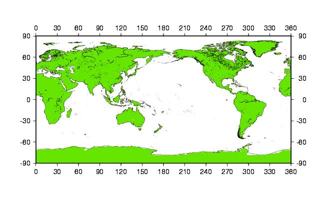 The green and white areas indicate values of 0 and 1, respectively. The coast lines if the GMT coast line. Mismatch of the coast line with the border between green and white areas indicates areas of land below sea level that is not ocean. Particularly around Antarctica, the mismatch is large. Ocean function after edits of low land areas, resolution is 5 minutes Same as above but with land areas below sea level considered as land. The ocean defined by this ocean function covers 70.98% of the Earth surface. Ocean function, resolution 2.5 degrees Note that this ocean function covers 71.37% of the Earth's surface. Due to a problem in GMT, the grid cells are shifted by 1.25 degrees on the plot. |